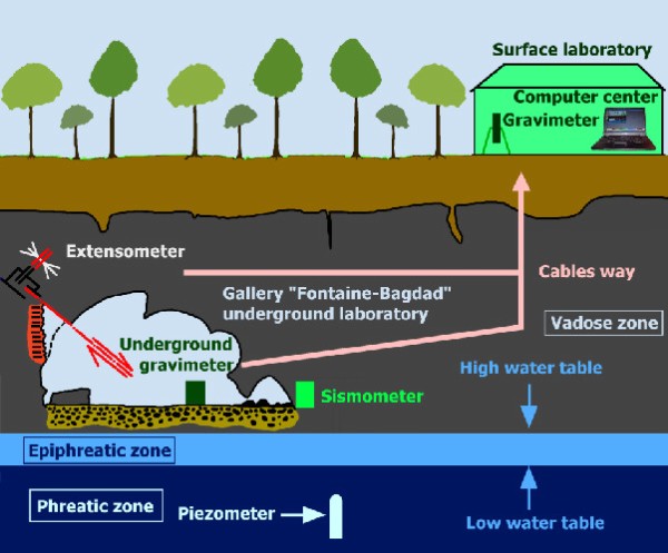
The present project proposes an innovative way to investigate the unsaturated zone flows and transport processes based on geophysical investigations (electrical tomography, spontaneous potential and gravimetric methods) that will be conducted at the RCL. Please refer to sections “Hydrogeology” and “Hydrogeophysics” for more information.
Challenges
In a changing environment, water availability becomes a critical issue worldwide. For both societal and ecological reasons, it is important to understand the dynamics of subsurface water but estimating subsurface water storage is notoriously difficult, especially in karstic areas. Karst aquifers, formed by the dissolution of carbonate rocks such as limestone or dolomite, supply drinking water to 25% of the world population (Mangin, 1975). Their heterogeneous sizes and hydrogeological characteristics are difficult to evaluate and present challenges for modelling storage capacities. In spite of their high value, karsts have long been considered difficult to model and exploit (Ford and Williams, 1997).
In karst aquifers, the void spaces consist of caves and conduits, smaller fissures, porous weathered zones (epikarst and ghost-rock) and porosity of the bedrock. In the saturated zone, from a drainage point of view, they are structured in two types of subsystems: the drains with low retention capacity and high permeability, and the annex systems with high capacity but weak connectivity to the drain. The drains are distinguished from the annex subsystems by very short residence time of water. The degree of interconnection or the permeability of the different subsystems can vary over several orders of magnitude. Because of the heterogeneity of such aquifers, it is not possible to know the spatial distribution of the different subsystems. When the system is flooded, the rise of the water table depends on the characteristics of the subsystems and the dynamic is essentially nonlinear. Little is known about the surface and groundwater interconnection, about the connection between the porous formations and the draining cave and conduits, and about the variability of groundwater volume within the system. Moreover, the system response depends on the saturation degree, such that the geometry of the aquifer is time-dependent. Finally, water inflows and outflows are highly variable and cannot be measured comprehensively.
Water dynamics in the unsaturated zone in karst systems
The epikarst zone is a subsystem of the unsaturated zone, which includes both soil and weathered rock. In some cases, this zone is an important perched water reservoir. Gravity measurements indicate that, in Rochefort, the epikarst may not store a large amount of water, although this may depend on the season , which has not yet been investigated.
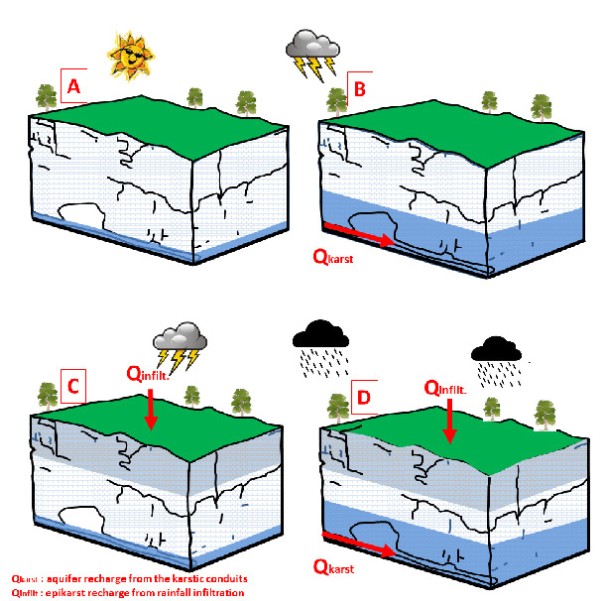
Previous monitoring has shown that various hydrogeological case studies could occur.
- A. Drought period: the Lomme river discharge reaches its base flow; the regional piezometric surface is near the resurgence altitude
- B. Heavy rainfall on the Lomme upper catchment: the aquifer is recharged by the flood that affects the karst system; the epikarst is not affected
- C. Local thunderstorm: due to the high permeability of the epikarst, infiltration occurs and the epikarst is recharged creating a temporally perched water reservoir. The regional piezometric level is not affected
- D. Regional heavy rainfall: the karst system and the epikarst are recharged. The aquifer is recharged and the regional piezometry is affected
There are only a few estimates of the porosity of the epikarst, ranging between 5 and 30 per cent. These values are speculative and may largely vary following rock type, climatic and other environment factors. The interactions between the hydrogeology of the epikarst and the rest of the unsaturated zone are also poorly quantified.
Geological Settings of Rochefort
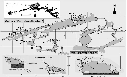
The LKS is located in Givetian limestones. It consists of a succession of caves and sinkholes located in the river bed or banks.
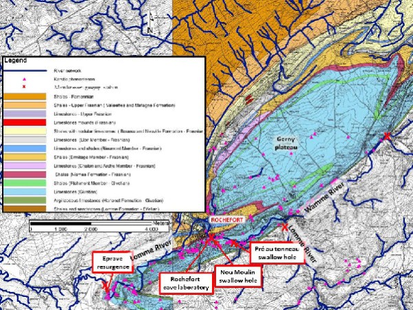
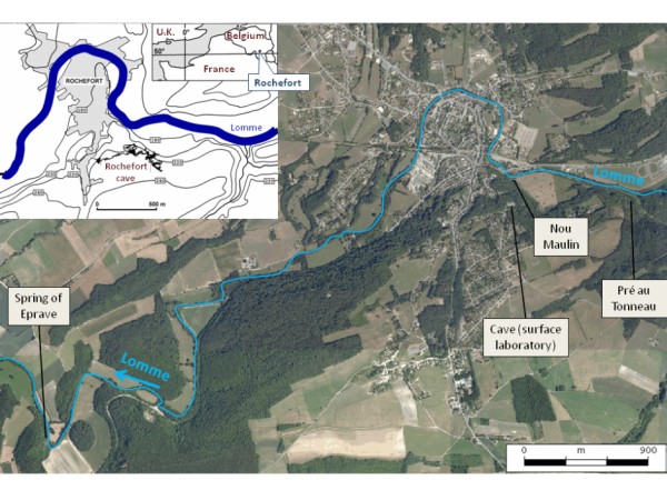
The karstic network that extends on more than 8 km, is generally oriented parallel to the stratification; locally transverse faults could change the conduit orientation. The caves are generally well mapped and the Lomme underground river is accessible at various spots. The resurgence of the whole system is located at the Eprave Vauclusian spring.