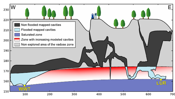
New paper evidencing unknown voids within the Lorette karst system, evidenced by the continuous gravity measurements of flash floods. This was first achieved with a gPhone spring gravimeter in 2013, continued with a superconducting gravimeter since end 2014.
Watlet A., Van Camp M., Francis O., Poulain A., Rochez G., Hallet V., Quinif Y., Kaufmann O., Gravity monitoring of underground flash flood events to study their impact on groundwater recharge and the distribution of karst voids, Water Resources Research, doi:10.1029/2019WR026673, 2020.